


SOLDIER TWP Voting District, Monona County, Iowa
About
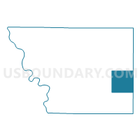
Outline

Summary
| Unique Area Identifier | 582875 |
| Name | SOLDIER TWP Voting District |
| County | Monona County |
| State | Iowa |
| Area (square miles) | 36.19 |
| Land Area (square miles) | 36.17 |
| Water Area (square miles) | 0.02 |
| % of Land Area | 99.96 |
| % of Water Area | 0.04 |
| Latitude of the Internal Point | 42.00461320 |
| Longtitude of the Internal Point | -95.73882690 |
Maps


Graphs
Select a template below for downloading or customizing gragh for SOLDIER TWP Voting District, Monona County, Iowa


Neighbors
Neighoring Voting District (by Name) Neighboring Voting District on the Map
- BOYER TWP W/O DUNLAP Voting District, Crawford County, IA
- CENTER TWP W/O CASTANA Voting District, Monona County, IA
- CHARTER OAK TWP Voting District, Crawford County, IA
- JORDAN TWP Voting District, Monona County, IA
- SPRING VALLEY TWP Voting District, Monona County, IA
- ST. CLAIR TWP Voting District, Monona County, IA
- WILLOW TWP Voting District, Crawford County, IA
- WILLOW TWP Voting District, Monona County, IA
Top 10 Neighboring County Subdivision (by Population) Neighboring County Subdivision on the Map
- Charter Oak township, Crawford County, IA (704)
- St. Clair township, Monona County, IA (517)
- Spring Valley township, Monona County, IA (402)
- Soldier township, Monona County, IA (342)
- Boyer township, Crawford County, IA (186)
- Jordan township, Monona County, IA (162)
- Center township, Monona County, IA (139)
- Willow township, Crawford County, IA (135)
- Willow township, Monona County, IA (91)
Top 10 Neighboring Place (by Population) Neighboring Place on the Map
Top 10 Neighboring Unified School District (by Population) Neighboring Unified School District on the Map
- West Harrison Community School District, IA (2,700)
- Boyer Valley Community School District, IA (2,699)
- Charter Oak-Ute Community School District, IA (1,933)